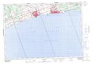
Maps showing Chub Point, Northumberland, Ontario
Chub Point is a Cape located in Northumberland, Ontario and has an elevation of 75 meters.
- Latitude: 43° 57' 48'' North (decimal: 43.9633333)
- Longitude: 78° 0' 25'' West (decimal: -78.0069444)
- Topography Feature Category: Cape
- Geographical Feature: Point
- Canadian Province/Territory: Ontario
- Elevation: 75 meters
- Location: Northumberland
- Atlas of Canada Locator Map: Chub Point
- GPS Coordinate Locator Map: Chub Point Lat/Long