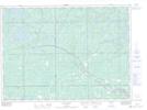
Maps showing Chudleigh, Sudbury, Ontario
Chudleigh is a Unincorporated area located in Sudbury, Ontario and has an elevation of 255 meters.
- Latitude: 46° 38' 29'' North (decimal: 46.6413888)
- Longitude: 80° 23' 2'' West (decimal: -80.3838888)
- Topography Feature Category: Unincorporated area
- Geographical Feature: Railway Point
- Canadian Province/Territory: Ontario
- Elevation: 255 meters
- Location: Sudbury
- Atlas of Canada Locator Map: Chudleigh
- GPS Coordinate Locator Map: Chudleigh Lat/Long