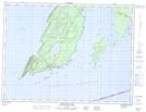
Maps showing Church Point, Thunder Bay, Ontario
Church Point is a Cape located in Thunder Bay, Ontario.
- Latitude: 48° 19' 46'' North (decimal: 48.3294444)
- Longitude: 88° 49' 27'' West (decimal: -88.8241666)
- Topography Feature Category: Cape
- Geographical Feature: Point
- Canadian Province/Territory: Ontario
- Location: Thunder Bay
- Atlas of Canada Locator Map: Church Point
- GPS Coordinate Locator Map: Church Point Lat/Long
Church Point NTS Map Sheets