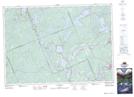
Maps showing Cinder Creek, Haliburton, Ontario
Cinder Creek is a River located in Haliburton, Ontario and has an elevation of 343 meters.
- Latitude: 45° 3' 42'' North (decimal: 45.0616666)
- Longitude: 78° 58' 20'' West (decimal: -78.9722222)
- Topography Feature Category: River
- Geographical Feature: Creek
- Canadian Province/Territory: Ontario
- Elevation: 343 meters
- Location: Haliburton
- Atlas of Canada Locator Map: Cinder Creek
- GPS Coordinate Locator Map: Cinder Creek Lat/Long
Cinder Creek NTS Map Sheets