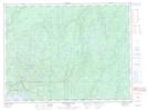
Maps showing Cirrus Creek, Thunder Bay, Ontario
Cirrus Creek is a River located in Thunder Bay, Ontario and has an elevation of 258 meters.
- Latitude: 48° 57' 46'' North (decimal: 48.9627777)
- Longitude: 86° 12' 45'' West (decimal: -86.2124999)
- Topography Feature Category: River
- Geographical Feature: Creek
- Canadian Province/Territory: Ontario
- Elevation: 258 meters
- Location: Thunder Bay
- Atlas of Canada Locator Map: Cirrus Creek
- GPS Coordinate Locator Map: Cirrus Creek Lat/Long
Cirrus Creek NTS Map Sheets