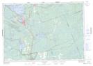
Maps showing Clark Island, Simcoe, Ontario
Clark Island is a Island located in Simcoe, Ontario.
- Latitude: 44° 46' 58'' North (decimal: 44.7827777)
- Longitude: 79° 17' 47'' West (decimal: -79.2963888)
- Topography Feature Category: Island
- Geographical Feature: Island
- Canadian Province/Territory: Ontario
- Location: Simcoe
- Atlas of Canada Locator Map: Clark Island
- GPS Coordinate Locator Map: Clark Island Lat/Long
Clark Island NTS Map Sheets