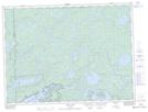
Maps showing Clay Lake, Thunder Bay, Ontario
Clay Lake is a Lake located in Thunder Bay, Ontario and has an elevation of 422 meters.
- Latitude: 48° 27' 19'' North (decimal: 48.4552777)
- Longitude: 90° 56' 3'' West (decimal: -90.9341666)
- Topography Feature Category: Lake
- Geographical Feature: Lake
- Canadian Province/Territory: Ontario
- Elevation: 422 meters
- Location: Thunder Bay
- Atlas of Canada Locator Map: Clay Lake
- GPS Coordinate Locator Map: Clay Lake Lat/Long