Canada Topographic Maps

Clearwater West Lake Topo Maps

Topography maps and Latitude/Longitude Location

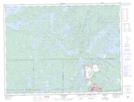
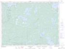
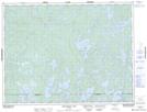
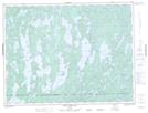
Maps showing Clearwater West Lake, Rainy River; Kenora, Ontario

Clearwater West Lake is a Lake located in Rainy River; Kenora, Ontario and has an elevation of 439 meters.

  • Latitude: 49° 0' 12'' North   (decimal: 49.0033333)
  • Longitude: 91° 58' 7'' West   (decimal: -91.9686111)
  • Topography Feature Category: Lake
  • Geographical Feature: Lake
  • Canadian Province/Territory: Ontario
  • Elevation: 439 meters
  • Location: Rainy River; Kenora
  • Atlas of Canada Locator Map: Clearwater West Lake
  • GPS Coordinate Locator Map: Clearwater West Lake Lat/Long

Clearwater West Lake NTS Map Sheets

052B13 Atikokan Topographic Map at 1:50,000 scale

052C16 Manion Lake Topographic Map at 1:50,000 scale

052F01 Pekagoning Lake Topographic Map at 1:50,000 scale

052G04 White Otter Lake Topographic Map at 1:50,000 scale

052B Quetico Topographic Map at 1:250,000 scale

052C International Falls Topographic Map at 1:250,000 scale

052F Dryden Topographic Map at 1:250,000 scale

052G Ignace Topographic Map at 1:250,000 scale

 
Buy Topographic Maps DVD
Newsletter Sign-up

Yes, I want to receive map store discounts.


Bookmark and Share