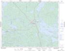
Maps showing Ear Falls, Kenora, Ontario
Ear Falls is a Other municipal/district area - miscellaneous located in Kenora, Ontario.
- Latitude: 50° 43' 45'' North (decimal: 50.7291666)
- Longitude: 93° 19' 18'' West (decimal: -93.3216666)
- Topography Feature Category: Other municipal/district area - miscellaneous
- Geographical Feature: Township Municipality
- Canadian Province/Territory: Ontario
- Location: Kenora
- Atlas of Canada Locator Map: Ear Falls
- GPS Coordinate Locator Map: Ear Falls Lat/Long
Ear Falls NTS Map Sheets