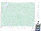
Maps showing Closs Lake Mountain, Renfrew, Ontario
Closs Lake Mountain is a Mountain located in Renfrew, Ontario and has an elevation of 307 meters.
- Latitude: 45° 12' 54'' North (decimal: 45.2149999)
- Longitude: 76° 44' 10'' West (decimal: -76.7361111)
- Topography Feature Category: Mountain
- Geographical Feature: Mountain
- Canadian Province/Territory: Ontario
- Elevation: 307 meters
- Location: Renfrew
- Atlas of Canada Locator Map: Closs Lake Mountain
- GPS Coordinate Locator Map: Closs Lake Mountain Lat/Long
Closs Lake Mountain NTS Map Sheets