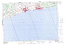
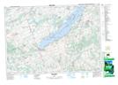
Maps showing Cobourg Brook, Northumberland, Ontario
Cobourg Brook is a River located in Northumberland, Ontario and has an elevation of 132 meters.
- Latitude: 43° 57' 15'' North (decimal: 43.9541666)
- Longitude: 78° 10' 35'' West (decimal: -78.1763888)
- Topography Feature Category: River
- Geographical Feature: Brook
- Canadian Province/Territory: Ontario
- Elevation: 132 meters
- Location: Northumberland
- Atlas of Canada Locator Map: Cobourg Brook
- GPS Coordinate Locator Map: Cobourg Brook Lat/Long
Cobourg Brook NTS Map Sheets