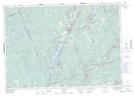
Maps showing Cockburn Island, Haliburton, Ontario
Cockburn Island is a Island located in Haliburton, Ontario and has an elevation of 331 meters.
- Latitude: 44° 59' 40'' North (decimal: 44.9944444)
- Longitude: 78° 41' 34'' West (decimal: -78.6927777)
- Topography Feature Category: Island
- Geographical Feature: Island
- Canadian Province/Territory: Ontario
- Elevation: 331 meters
- Location: Haliburton
- Atlas of Canada Locator Map: Cockburn Island
- GPS Coordinate Locator Map: Cockburn Island Lat/Long