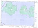
Maps showing Cockburn Island, Manitoulin, Ontario
Cockburn Island is a Geographical area located in Manitoulin, Ontario and has an elevation of 238 meters.
- Latitude: 45° 55' 23'' North (decimal: 45.9230555)
- Longitude: 83° 22' 11'' West (decimal: -83.3697222)
- Topography Feature Category: Geographical area
- Geographical Feature: Geographic Township
- Canadian Province/Territory: Ontario
- Elevation: 238 meters
- Location: Manitoulin
- Atlas of Canada Locator Map: Cockburn Island
- GPS Coordinate Locator Map: Cockburn Island Lat/Long