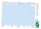
Maps showing Collier Shoal, Northumberland, Ontario
Collier Shoal is a Shoal located in Northumberland, Ontario.
- Latitude: 43° 57' 42'' North (decimal: 43.9616666)
- Longitude: 77° 48' 42'' West (decimal: -77.8116666)
- Topography Feature Category: Shoal
- Geographical Feature: Shoal
- Canadian Province/Territory: Ontario
- Location: Northumberland
- Atlas of Canada Locator Map: Collier Shoal
- GPS Coordinate Locator Map: Collier Shoal Lat/Long