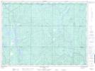
Maps showing Conglomerate Chute, Sudbury, Ontario
Conglomerate Chute is a Falls located in Sudbury, Ontario.
- Latitude: 47° 16' 38'' North (decimal: 47.2772222)
- Longitude: 81° 14' 36'' West (decimal: -81.2433333)
- Topography Feature Category: Falls
- Geographical Feature: Chute
- Canadian Province/Territory: Ontario
- Location: Sudbury
- Atlas of Canada Locator Map: Conglomerate Chute
- GPS Coordinate Locator Map: Conglomerate Chute Lat/Long
Conglomerate Chute NTS Map Sheets