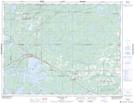
Maps showing Connaught Point, Kenora, Ontario
Connaught Point is a Cape located in Kenora, Ontario and has an elevation of 369 meters.
- Latitude: 49° 45' 27'' North (decimal: 49.7574999)
- Longitude: 93° 21' 56'' West (decimal: -93.3655555)
- Topography Feature Category: Cape
- Geographical Feature: Point
- Canadian Province/Territory: Ontario
- Elevation: 369 meters
- Location: Kenora
- Atlas of Canada Locator Map: Connaught Point
- GPS Coordinate Locator Map: Connaught Point Lat/Long
Connaught Point NTS Map Sheets