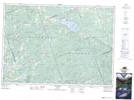
Maps showing Copp, Renfrew, Ontario
Copp is a Unincorporated area located in Renfrew, Ontario.
- Latitude: 45° 28' 7'' North (decimal: 45.4686111)
- Longitude: 77° 27' 6'' West (decimal: -77.4516666)
- Topography Feature Category: Unincorporated area
- Geographical Feature: Dispersed Rural Community
- Canadian Province/Territory: Ontario
- Location: Renfrew
- Atlas of Canada Locator Map: Copp
- GPS Coordinate Locator Map: Copp Lat/Long