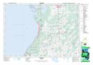
Maps showing Copperkettle, Grey, Ontario
Copperkettle is a Unincorporated area located in Grey, Ontario and has an elevation of 241 meters.
- Latitude: 44° 38' 55'' North (decimal: 44.6486111)
- Longitude: 81° 0' 19'' West (decimal: -81.0052777)
- Topography Feature Category: Unincorporated area
- Geographical Feature: Locality
- Canadian Province/Territory: Ontario
- Elevation: 241 meters
- Location: Grey
- Atlas of Canada Locator Map: Copperkettle
- GPS Coordinate Locator Map: Copperkettle Lat/Long