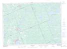
Maps showing Corkery Falls, Ontario
Corkery Falls is a Falls located in Ontario and has an elevation of 305 meters.
- Latitude: 45° 59' 20'' North (decimal: 45.9888999)
- Longitude: 79° 25' 15'' West (decimal: -79.4207999)
- Topography Feature Category: Falls
- Geographical Feature: Falls
- Canadian Province/Territory: Ontario
- Elevation: 305 meters
- GPS Coordinate Locator Map: Corkery Falls Lat/Long
Corkery Falls NTS Map Sheets