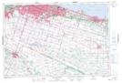
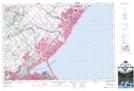
Maps showing Corktown, Wentworth, Ontario
Corktown is a Unincorporated area located in Wentworth, Ontario and has an elevation of 133 meters.
- Latitude: 43° 14' 57'' North (decimal: 43.2491666)
- Longitude: 79° 52' 1'' West (decimal: -79.8669444)
- Topography Feature Category: Unincorporated area
- Geographical Feature: Urban Community
- Canadian Province/Territory: Ontario
- Elevation: 133 meters
- Location: Wentworth
- Atlas of Canada Locator Map: Corktown
- GPS Coordinate Locator Map: Corktown Lat/Long
Corktown NTS Map Sheets