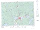
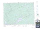
Maps showing Cotter Lake, Muskoka, Ontario
Cotter Lake is a Lake located in Muskoka, Ontario and has an elevation of 385 meters.
- Latitude: 45° 21' 16'' North (decimal: 45.3544000)
- Longitude: 78° 59' 55'' West (decimal: -78.9986000)
- Topography Feature Category: Lake
- Geographical Feature: Lake
- Canadian Province/Territory: Ontario
- Elevation: 385 meters
- Location: Muskoka
- Atlas of Canada Locator Map: Cotter Lake
- GPS Coordinate Locator Map: Cotter Lake Lat/Long
Cotter Lake NTS Map Sheets