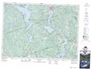
Maps showing Craigmont Hill, Renfrew, Ontario
Craigmont Hill is a Mountain located in Renfrew, Ontario and has an elevation of 404 meters.
- Latitude: 45° 18' 21'' North (decimal: 45.3058333)
- Longitude: 77° 37' 9'' West (decimal: -77.6191666)
- Topography Feature Category: Mountain
- Geographical Feature: Hill
- Canadian Province/Territory: Ontario
- Elevation: 404 meters
- Location: Renfrew
- Atlas of Canada Locator Map: Craigmont Hill
- GPS Coordinate Locator Map: Craigmont Hill Lat/Long
Craigmont Hill NTS Map Sheets