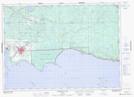
Maps showing Cranberry Marsh, Nipissing, Ontario
Cranberry Marsh is a Low vegetation located in Nipissing, Ontario and has an elevation of 201 meters.
- Latitude: 46° 19' 30'' North (decimal: 46.3249999)
- Longitude: 79° 58' 59'' West (decimal: -79.9830555)
- Topography Feature Category: Low vegetation
- Geographical Feature: Marsh
- Canadian Province/Territory: Ontario
- Elevation: 201 meters
- Location: Nipissing
- Atlas of Canada Locator Map: Cranberry Marsh
- GPS Coordinate Locator Map: Cranberry Marsh Lat/Long
Cranberry Marsh NTS Map Sheets