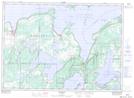
Maps showing Cranberry Marsh, Manitoulin, Ontario
Cranberry Marsh is a Low vegetation located in Manitoulin, Ontario and has an elevation of 270 meters.
- Latitude: 45° 51' 38'' North (decimal: 45.8605555)
- Longitude: 82° 5' 34'' West (decimal: -82.0927777)
- Topography Feature Category: Low vegetation
- Geographical Feature: Marsh
- Canadian Province/Territory: Ontario
- Elevation: 270 meters
- Location: Manitoulin
- Atlas of Canada Locator Map: Cranberry Marsh
- GPS Coordinate Locator Map: Cranberry Marsh Lat/Long