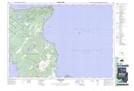
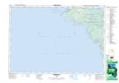
Maps showing Crane River, Bruce, Ontario
Crane River is a River located in Bruce, Ontario and has an elevation of 185 meters.
- Latitude: 45° 7' 30'' North (decimal: 45.1250000)
- Longitude: 81° 32' 36'' West (decimal: -81.5433333)
- Topography Feature Category: River
- Geographical Feature: River
- Canadian Province/Territory: Ontario
- Elevation: 185 meters
- Location: Bruce
- Atlas of Canada Locator Map: Crane River
- GPS Coordinate Locator Map: Crane River Lat/Long
Crane River NTS Map Sheets