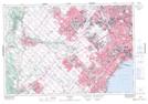
Maps showing Credit River (Georgetown Branch), Ontario
Credit River (Georgetown Branch) is a River located in Ontario.
- Latitude: 43° 39' North (decimal: 43.6500000)
- Longitude: 79° 52' West (decimal: -79.8667000)
- Topography Feature Category: River
- Geographical Feature: Branch
- Canadian Province/Territory: Ontario
- GPS Coordinate Locator Map: Credit River (Georgetown Branch) Lat/Long