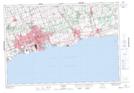
Maps showing Crooked Creek, Durham, Ontario
Crooked Creek is a Unincorporated area located in Durham, Ontario and has an elevation of 159 meters.
- Latitude: 43° 58' 26'' North (decimal: 43.9738888)
- Longitude: 78° 30' 42'' West (decimal: -78.5116666)
- Topography Feature Category: Unincorporated area
- Geographical Feature: Dispersed Rural Community
- Canadian Province/Territory: Ontario
- Elevation: 159 meters
- Location: Durham
- Atlas of Canada Locator Map: Crooked Creek
- GPS Coordinate Locator Map: Crooked Creek Lat/Long