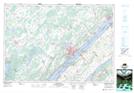
Maps showing Croziers Island, Leeds, Ontario
Croziers Island is a Island located in Leeds, Ontario and has an elevation of 87 meters.
- Latitude: 44° 31' 12'' North (decimal: 44.5200000)
- Longitude: 76° 0' 18'' West (decimal: -76.0049999)
- Topography Feature Category: Island
- Geographical Feature: Island
- Canadian Province/Territory: Ontario
- Elevation: 87 meters
- Location: Leeds
- Atlas of Canada Locator Map: Croziers Island
- GPS Coordinate Locator Map: Croziers Island Lat/Long
Croziers Island NTS Map Sheets