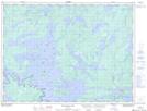
Maps showing Cub Point, Rainy River, Ontario
Cub Point is a Cape located in Rainy River, Ontario and has an elevation of 346 meters.
- Latitude: 48° 53' 54'' North (decimal: 48.8983333)
- Longitude: 93° 21' 17'' West (decimal: -93.3547222)
- Topography Feature Category: Cape
- Geographical Feature: Point
- Canadian Province/Territory: Ontario
- Elevation: 346 meters
- Location: Rainy River
- Atlas of Canada Locator Map: Cub Point
- GPS Coordinate Locator Map: Cub Point Lat/Long
Cub Point NTS Map Sheets