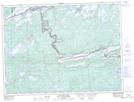
Maps showing Curtis Island, Thunder Bay, Ontario
Curtis Island is a Island located in Thunder Bay, Ontario and has an elevation of 435 meters.
- Latitude: 48° 13' 57'' North (decimal: 48.2324999)
- Longitude: 90° 38' 56'' West (decimal: -90.6488888)
- Topography Feature Category: Island
- Geographical Feature: Island
- Canadian Province/Territory: Ontario
- Elevation: 435 meters
- Location: Thunder Bay
- Atlas of Canada Locator Map: Curtis Island
- GPS Coordinate Locator Map: Curtis Island Lat/Long
Curtis Island NTS Map Sheets