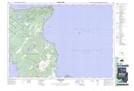
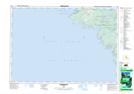
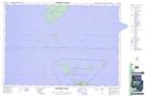
Maps showing Cyprus Lake Provincial Park, Ontario
Cyprus Lake Provincial Park is a Conservation area located in Ontario.
- Latitude: 45° 14' North (decimal: 45.2332999)
- Longitude: 81° 36' West (decimal: -81.5999999)
- Topography Feature Category: Conservation area
- Geographical Feature: Provincial Park
- Canadian Province/Territory: Ontario
- GPS Coordinate Locator Map: Cyprus Lake Provincial Park Lat/Long
Cyprus Lake Provincial Park NTS Map Sheets