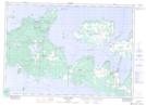
Maps showing Cyril Cove, Ontario
Cyril Cove is a Bay located in Ontario.
- Latitude: 45° 58' North (decimal: 45.9666999)
- Longitude: 82° 51' West (decimal: -82.8500000)
- Topography Feature Category: Bay
- Geographical Feature: Cove
- Canadian Province/Territory: Ontario
- GPS Coordinate Locator Map: Cyril Cove Lat/Long
Cyril Cove NTS Map Sheets