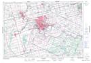
Maps showing D'Aubigny Creek, Brant, Ontario
D'Aubigny Creek is a River located in Brant, Ontario.
- Latitude: 43° 8' 17'' North (decimal: 43.1380555)
- Longitude: 80° 16' 56'' West (decimal: -80.2822222)
- Topography Feature Category: River
- Geographical Feature: Creek
- Canadian Province/Territory: Ontario
- Location: Brant
- Atlas of Canada Locator Map: D'Aubigny Creek
- GPS Coordinate Locator Map: D'Aubigny Creek Lat/Long
D'Aubigny Creek NTS Map Sheets