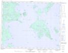
Maps showing Dawson Island, Thunder Bay, Ontario
Dawson Island is a Island located in Thunder Bay, Ontario and has an elevation of 291 meters.
- Latitude: 49° 51' 9'' North (decimal: 49.8525000)
- Longitude: 88° 32' 13'' West (decimal: -88.5369444)
- Topography Feature Category: Island
- Geographical Feature: Island
- Canadian Province/Territory: Ontario
- Elevation: 291 meters
- Location: Thunder Bay
- Atlas of Canada Locator Map: Dawson Island
- GPS Coordinate Locator Map: Dawson Island Lat/Long
Dawson Island NTS Map Sheets