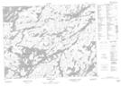
Maps showing Day Lake, Thunder Bay, Ontario
Day Lake is a Lake located in Thunder Bay, Ontario and has an elevation of 399 meters.
- Latitude: 50° 57' 13'' North (decimal: 50.9536111)
- Longitude: 90° 44' 11'' West (decimal: -90.7363888)
- Topography Feature Category: Lake
- Geographical Feature: Lake
- Canadian Province/Territory: Ontario
- Elevation: 399 meters
- Location: Thunder Bay
- Atlas of Canada Locator Map: Day Lake
- GPS Coordinate Locator Map: Day Lake Lat/Long
Day Lake NTS Map Sheets