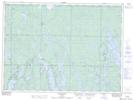
Maps showing Dead Horse Island, Sudbury, Ontario
Dead Horse Island is a Island located in Sudbury, Ontario and has an elevation of 417 meters.
- Latitude: 47° 20' 40'' North (decimal: 47.3444444)
- Longitude: 82° 3' 39'' West (decimal: -82.0608333)
- Topography Feature Category: Island
- Geographical Feature: Island
- Canadian Province/Territory: Ontario
- Elevation: 417 meters
- Location: Sudbury
- Atlas of Canada Locator Map: Dead Horse Island
- GPS Coordinate Locator Map: Dead Horse Island Lat/Long
Dead Horse Island NTS Map Sheets