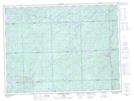
Maps showing Delusion Creek, Algoma, Ontario
Delusion Creek is a River located in Algoma, Ontario and has an elevation of 353 meters.
- Latitude: 48° 19' 35'' North (decimal: 48.3263888)
- Longitude: 84° 40' 36'' West (decimal: -84.6766666)
- Topography Feature Category: River
- Geographical Feature: Creek
- Canadian Province/Territory: Ontario
- Elevation: 353 meters
- Location: Algoma
- Atlas of Canada Locator Map: Delusion Creek
- GPS Coordinate Locator Map: Delusion Creek Lat/Long
Delusion Creek NTS Map Sheets