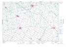
Maps showing Derrynane, Wellington, Ontario
Derrynane is a Unincorporated area located in Wellington, Ontario and has an elevation of 466 meters.
- Latitude: 43° 56' 43'' North (decimal: 43.9452777)
- Longitude: 80° 35' 22'' West (decimal: -80.5894444)
- Topography Feature Category: Unincorporated area
- Geographical Feature: Dispersed Rural Community
- Canadian Province/Territory: Ontario
- Elevation: 466 meters
- Location: Wellington
- Atlas of Canada Locator Map: Derrynane
- GPS Coordinate Locator Map: Derrynane Lat/Long
Derrynane NTS Map Sheets