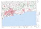
Maps showing Devils Den, Ontario, Ontario
Devils Den is a Valley located in Ontario, Ontario and has an elevation of 128 meters.
- Latitude: 43° 56' 00'' North (decimal: 43.9333333)
- Longitude: 78° 59' 12'' West (decimal: -78.9866666)
- Topography Feature Category: Valley
- Geographical Feature: Gorge
- Canadian Province/Territory: Ontario
- Elevation: 128 meters
- Location: Ontario
- Atlas of Canada Locator Map: Devils Den
- GPS Coordinate Locator Map: Devils Den Lat/Long