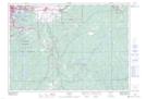
Maps showing Dill Siding, Sudbury, Ontario
Dill Siding is a Unincorporated area located in Sudbury, Ontario and has an elevation of 237 meters.
- Latitude: 46° 25' 32'' North (decimal: 46.4255555)
- Longitude: 80° 50' 20'' West (decimal: -80.8388888)
- Topography Feature Category: Unincorporated area
- Geographical Feature: Railway Point
- Canadian Province/Territory: Ontario
- Elevation: 237 meters
- Location: Sudbury
- Atlas of Canada Locator Map: Dill Siding
- GPS Coordinate Locator Map: Dill Siding Lat/Long