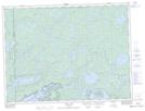
Maps showing District Lake, Thunder Bay; Rainy River, Ontario
District Lake is a Lake located in Thunder Bay; Rainy River, Ontario and has an elevation of 489 meters.
- Latitude: 48° 22' 7'' North (decimal: 48.3686111)
- Longitude: 90° 57' 55'' West (decimal: -90.9652777)
- Topography Feature Category: Lake
- Geographical Feature: Lake
- Canadian Province/Territory: Ontario
- Elevation: 489 meters
- Location: Thunder Bay; Rainy River
- Atlas of Canada Locator Map: District Lake
- GPS Coordinate Locator Map: District Lake Lat/Long