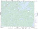
Maps showing Dixie Creek, Kenora, Ontario
Dixie Creek is a River located in Kenora, Ontario and has an elevation of 349 meters.
- Latitude: 50° 50' 13'' North (decimal: 50.8369444)
- Longitude: 93° 28' 58'' West (decimal: -93.4827777)
- Topography Feature Category: River
- Geographical Feature: Creek
- Canadian Province/Territory: Ontario
- Elevation: 349 meters
- Location: Kenora
- Atlas of Canada Locator Map: Dixie Creek
- GPS Coordinate Locator Map: Dixie Creek Lat/Long
Dixie Creek NTS Map Sheets