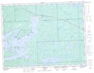
Maps showing Doats Lake, Thunder Bay, Ontario
Doats Lake is a Lake located in Thunder Bay, Ontario and has an elevation of 487 meters.
- Latitude: 48° 51' 27'' North (decimal: 48.8574999)
- Longitude: 90° 9' 39'' West (decimal: -90.1608333)
- Topography Feature Category: Lake
- Geographical Feature: Lake
- Canadian Province/Territory: Ontario
- Elevation: 487 meters
- Location: Thunder Bay
- Atlas of Canada Locator Map: Doats Lake
- GPS Coordinate Locator Map: Doats Lake Lat/Long