Canada Topographic Maps

Dobie River Topo Maps

Topography maps and Latitude/Longitude Location

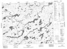
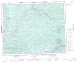
Maps showing Dobie River, Kenora, Ontario

Dobie River is a River located in Kenora, Ontario and has an elevation of 359 meters.

  • Latitude: 51° 41' 13'' North   (decimal: 51.6869444)
  • Longitude: 90° 28' 32'' West   (decimal: -90.4755555)
  • Topography Feature Category: River
  • Geographical Feature: River
  • Canadian Province/Territory: Ontario
  • Elevation: 359 meters
  • Location: Kenora
  • Atlas of Canada Locator Map: Dobie River
  • GPS Coordinate Locator Map: Dobie River Lat/Long

Dobie River NTS Map Sheets

052O05 Zionz Lake Topographic Map at 1:50,000 scale

052O06 Obaskaka Lake Topographic Map at 1:50,000 scale

052O07 Kawinogans Lake Topographic Map at 1:50,000 scale

052O09 Tarp Lake Topographic Map at 1:50,000 scale

052O10 Dobie River Topographic Map at 1:50,000 scale

052O Lake St Joseph Topographic Map at 1:250,000 scale

 
Buy Topographic Maps DVD
Newsletter Sign-up

Yes, I want to receive map store discounts.


Bookmark and Share