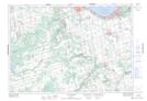
Maps showing Castle Glen Estates, Grey, Ontario
Castle Glen Estates is a Unincorporated area located in Grey, Ontario and has an elevation of 444 meters.
- Latitude: 44° 27' 47'' North (decimal: 44.4630555)
- Longitude: 80° 19' 33'' West (decimal: -80.3258333)
- Topography Feature Category: Unincorporated area
- Geographical Feature: Dispersed Rural Community
- Canadian Province/Territory: Ontario
- Elevation: 444 meters
- Location: Grey
- Atlas of Canada Locator Map: Castle Glen Estates
- GPS Coordinate Locator Map: Castle Glen Estates Lat/Long
Castle Glen Estates NTS Map Sheets