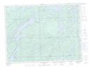
Maps showing Dalton Mills, Algoma, Ontario
Dalton Mills is a Unincorporated area located in Algoma, Ontario and has an elevation of 349 meters.
- Latitude: 48° 7' 18'' North (decimal: 48.1216666)
- Longitude: 84° 4' 16'' West (decimal: -84.0711111)
- Topography Feature Category: Unincorporated area
- Geographical Feature: Dispersed Rural Community
- Canadian Province/Territory: Ontario
- Elevation: 349 meters
- Location: Algoma
- Atlas of Canada Locator Map: Dalton Mills
- GPS Coordinate Locator Map: Dalton Mills Lat/Long
Dalton Mills NTS Map Sheets