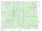
Maps showing Lac à la Plonge, Algoma, Ontario
Lac à la Plonge is a Lake located in Algoma, Ontario and has an elevation of 423 meters.
- Latitude: 48° 13' 15'' North (decimal: 48.2208333)
- Longitude: 85° 3' 33'' West (decimal: -85.0591666)
- Topography Feature Category: Lake
- Geographical Feature: Lac
- Canadian Province/Territory: Ontario
- Elevation: 423 meters
- Location: Algoma
- Atlas of Canada Locator Map: Lac à la Plonge
- GPS Coordinate Locator Map: Lac à la Plonge Lat/Long
Lac à la Plonge NTS Map Sheets