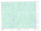
Maps showing Upper McGill Lake, Thunder Bay, Ontario
Upper McGill Lake is a Lake located in Thunder Bay, Ontario and has an elevation of 352 meters.
- Latitude: 48° 56' 21'' North (decimal: 48.9391666)
- Longitude: 85° 29' 2'' West (decimal: -85.4838888)
- Topography Feature Category: Lake
- Geographical Feature: Lake
- Canadian Province/Territory: Ontario
- Elevation: 352 meters
- Location: Thunder Bay
- Atlas of Canada Locator Map: Upper McGill Lake
- GPS Coordinate Locator Map: Upper McGill Lake Lat/Long
Upper McGill Lake NTS Map Sheets