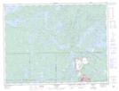
Maps showing Olcott, Rainy River, Ontario
Olcott is a Unincorporated area located in Rainy River, Ontario and has an elevation of 422 meters.
- Latitude: 48° 45' 22'' North (decimal: 48.7561111)
- Longitude: 91° 30' 12'' West (decimal: -91.5033333)
- Topography Feature Category: Unincorporated area
- Geographical Feature: Railway Point
- Canadian Province/Territory: Ontario
- Elevation: 422 meters
- Location: Rainy River
- Atlas of Canada Locator Map: Olcott
- GPS Coordinate Locator Map: Olcott Lat/Long