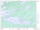
Maps showing Oakpoint Island, Rainy River, Ontario
Oakpoint Island is a Island located in Rainy River, Ontario and has an elevation of 353 meters.
- Latitude: 48° 30' 54'' North (decimal: 48.5150000)
- Longitude: 92° 36' 52'' West (decimal: -92.6144444)
- Topography Feature Category: Island
- Geographical Feature: Island
- Canadian Province/Territory: Ontario
- Elevation: 353 meters
- Location: Rainy River
- Atlas of Canada Locator Map: Oakpoint Island
- GPS Coordinate Locator Map: Oakpoint Island Lat/Long
Oakpoint Island NTS Map Sheets